
Autores:
Zurita C. Marco A., (2)
Aguilar C. Wilbert G. (1)
Enríquez Ch. Victor X. (2)
(1) University of the Armed Forces-ESPE, Sangolqui, Ecuador
(2) Ecuadorian Air Force Research and Development Center, Ambato, Ecuador
Abstract.
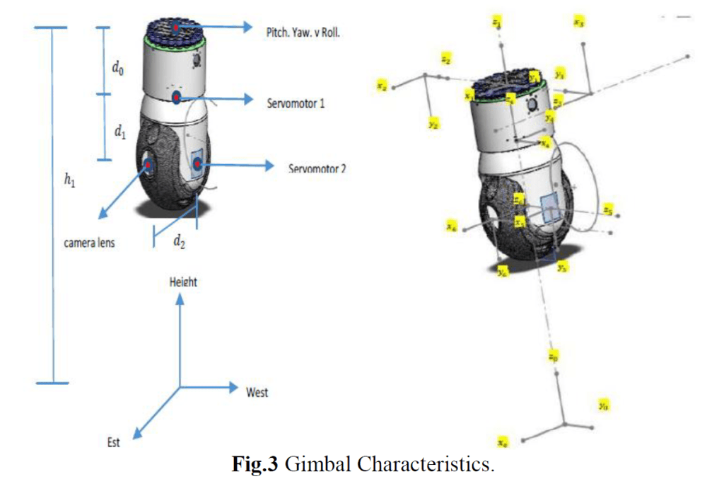
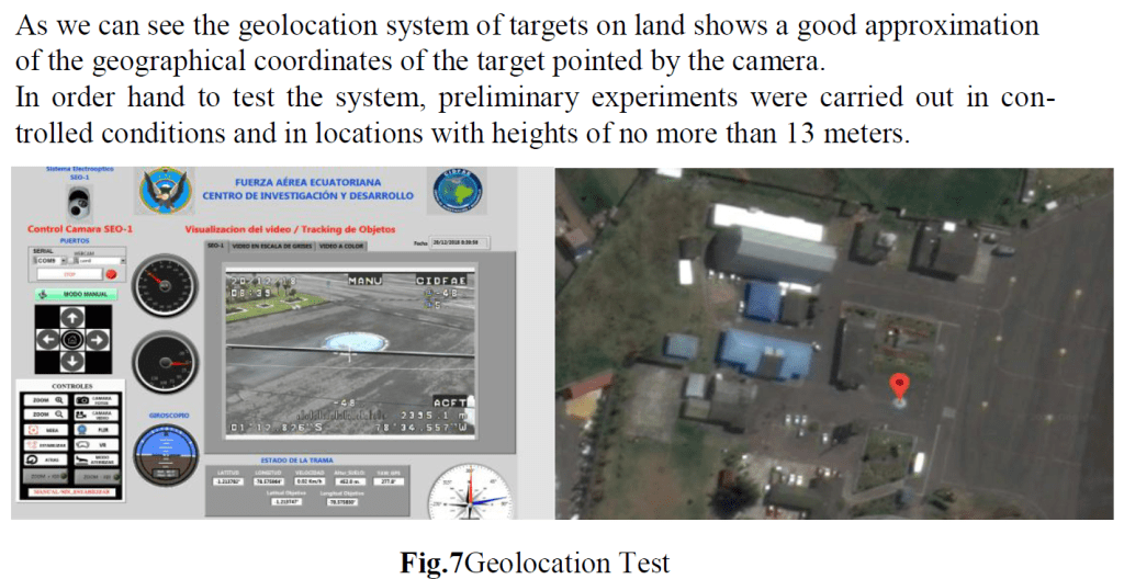
This paper presents the progress of a research work that seeks to de-termine the geographic coordinates of an object on land of interest by applying the Denavit-Hartemberg methodology to the surveillance and recognition sys-tem developed in the CID-FAE SEO-D1, this together with mathematical carto-graphy will provide information in support of military operations. The results shown in the simulation present a good approximation of the geographic coor-dinates of interest. In the light of the above, it is suggested that this kind of study provides a low-cost surveillance and reconnaissance alternative to exist-ing advanced systems such as satellites for countries that do not have this type of technology, as is the case of Ecuador.
Para descarga del artículo completo:
Continúa navegando en el blog:
Sigue mi blog
«Sé tú mismo, los demás puestos están ocupados» Oscar Wilde
